

The system provides a way for trail organizations and trail users to get information on a website and on their smartphones on up to date trail conditions. The project is rapidly evolving from a system intended for the Hydrocut to a system meant for all trail systems. New features are being added as they come up.
The original motivation for the project is to be able find out trail conditions without having to travel to the trails to determine if they are muddy, icy, or generally rideable. In Ontario, mountain bike trails are closed to riders to protect the trails from damage and erosion. This project that aims to ease the work of volunteers in determining if the trails should be open. However, it has become apparent that there is no succinct way for a trail user to find out trail conditions on their favourite trails. We intend to provide that method. The one place on the internet or on their smart phones where you can find out which of your favourite trails are ridden before you head out. Additionally, we intend to solve other issues such as becoming a trail member. One app with all the information in one place. Yes, there is Trailforks, but the serves a different purpose. We do not intend to provide trail maps and such, but we want to know where to ride when the conditions warrent checking before riding....or better yet, we want to get notifications - "shread alerts" - when trails are calling you. Look forward to a new system for mountain biking.
...and possible other trail system types in the future. Yes, we are aware that this technology is applicable to other trail types such as hiking, downhill skiing, nordic skilling, etc., but our primary focus, at the start, will be mountain biking. Are team are all mountain bikes, and we are starting with what we know...and expand later as we understand the problems of other trail types. We want to provide solutions to problems and not invent problems to solve.
The system started some two years ago with a desire to know trail conditions before heading out the trails. That said, the details of the system are evolving on an exponential basis as the number of sensors, the type of data collected is increasing, and what we do with it changes. Even over the last month or more, we've changed to a system that supports just the Hydrocut to something that can support any trail system. Some of the details of the project started are outlined in IOT Magazine. Read about the project in the story Why Eat Raspberry PI when Arduino Fruit will do on Medium.com
We are developing a hardware and software platform to put all the information trail organizations, trail crew, and trail users need into one place.
The solar charger is based on a 235W Solarwinds panel driving a EPever Tracer 10 charge controller running a 20AH 24V battery pack. The solar charge is connected to a ESP32 modbus logger and reports data to AWS IoT Core and uses Grafana running in AWS Fargate to display Solar Charger Data.
This website is a static html page and some javascript code and is a simple placeholder. The current testing version of the website is built on React and is hosted in AWS Amplify.
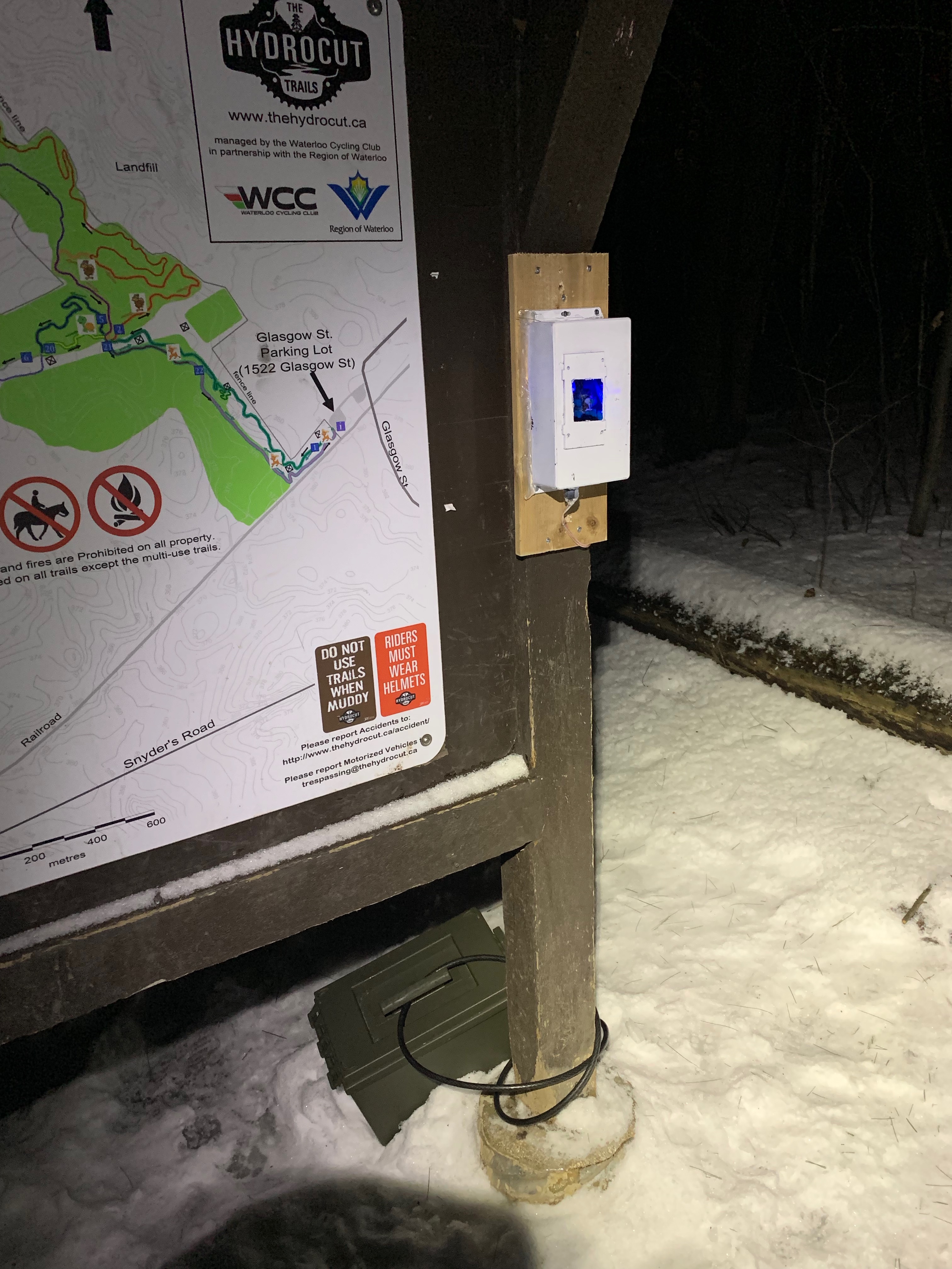
The trail status monitor is a stop light like device to the mirrors the trail status. Android and iPhone apps will notify users of trail status when it changes as well as up to the minute trail conditions.
Integrated sensors to provide sun, wind, temperature, pressure, soil temperature, soil moisture type data to the cloud. All sensors log to AWS IoT Core. Currently, Grafana is used as the dasboard and is runing on AWS Fargate
Our system uses AWS IoT core and AWS Timestream for storing and retrieving data.
Currently under test is a sensor system consisting of soil moisture, soil temperature, and rainfall detection. We plan to build on this system and deploy them throughout the forest using low power radio transmitters to get the data back to the trailhead for transmission to the internet. Once we have a large enough sensor network and enough data to process, we will use AI to review the data. The goal is to have sensor network determine if the trails should be opened or closed automatically without human intervention. AWS offers a AI service to mine the data to find trends. We intend explore these options. Additionally, AWS does image processing both localling using AWS GreenGrass and cloud services to process image data to allow us to determine trail usership by using cameras at the trailhead. We could even deploy cameras at the trailhead to determine number of open parking spots, or if a bike theft is happening. There are lots possiblities.
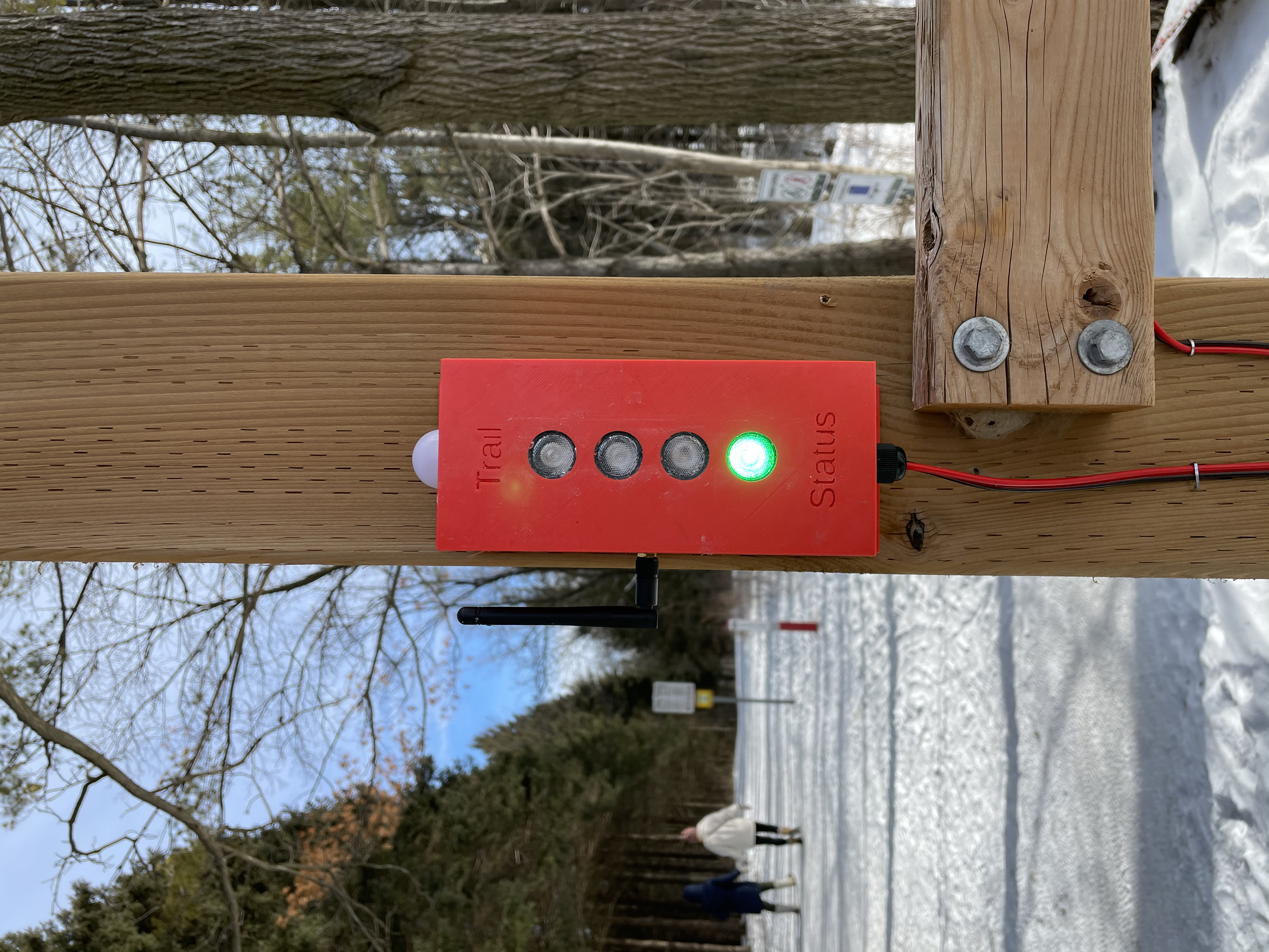
Finished trail status monitor placed at the trailhead to inform users of the trail open/close status.
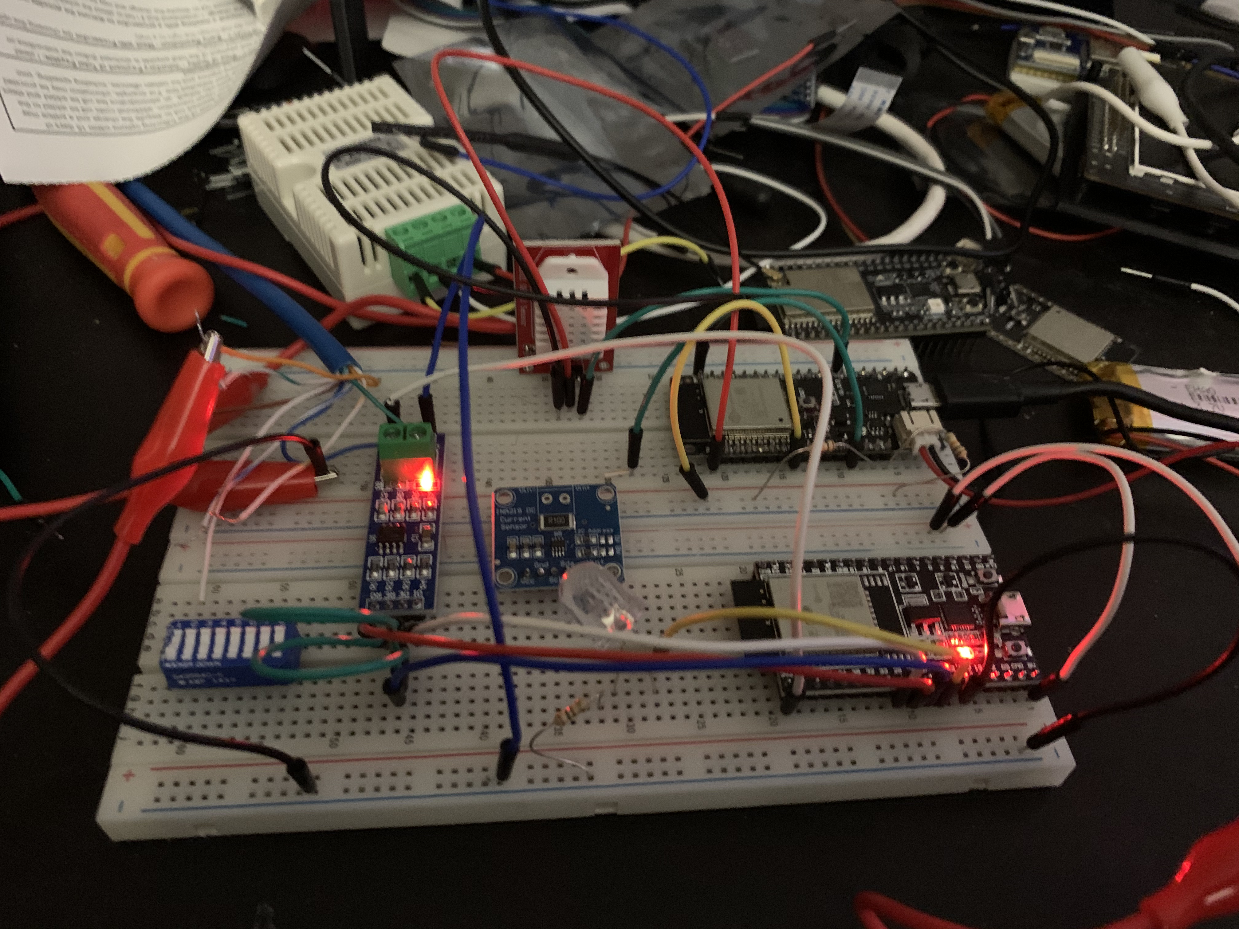
The ESP32 device makes for easy prototyping. The ESP-IDF SDK includes most of the code require to operate the device for the different busses needed. Code is written in C or C++.
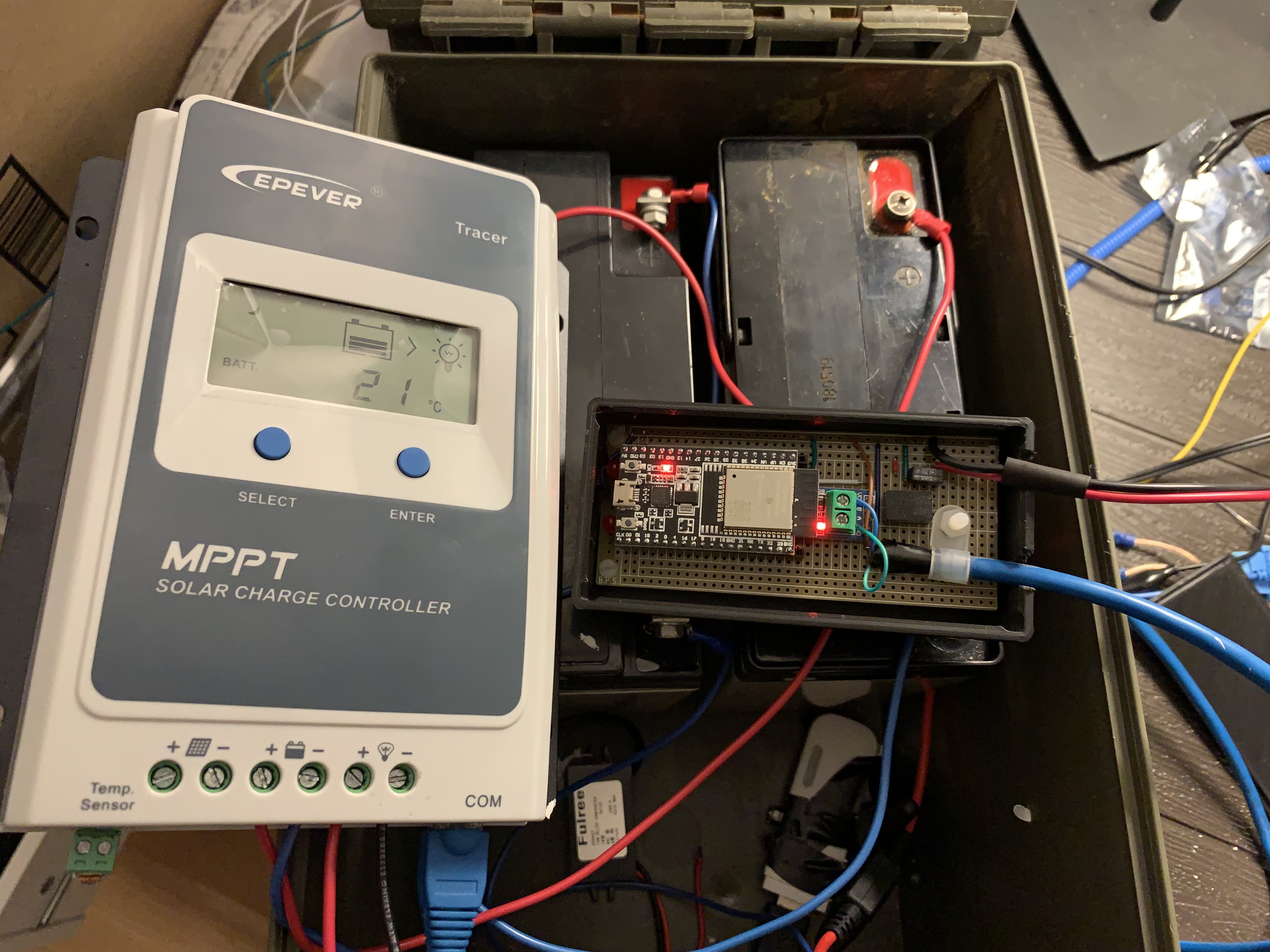
Interfacing to the modbus on the EPever controller was a simple matter. The ESP32 reads the read time data from the solar charger, and uploads the data to AWS IOT core.
Using an embedded camera and a 3G modem, this trail camera device, based on a Raspberry PI, sent images to twitter. THis camera has since been retired.